|
|
| Placer Mining Claims For Sale | ||||||||||||||||||||||||||||||||||||||||||||||||||||||||||||
|
|
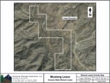
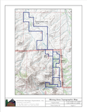
Mustang Project Arizona State Mineral Lease Placer Operation ±140 Acres Price: $85,000 Arizona State Land Department:
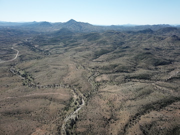
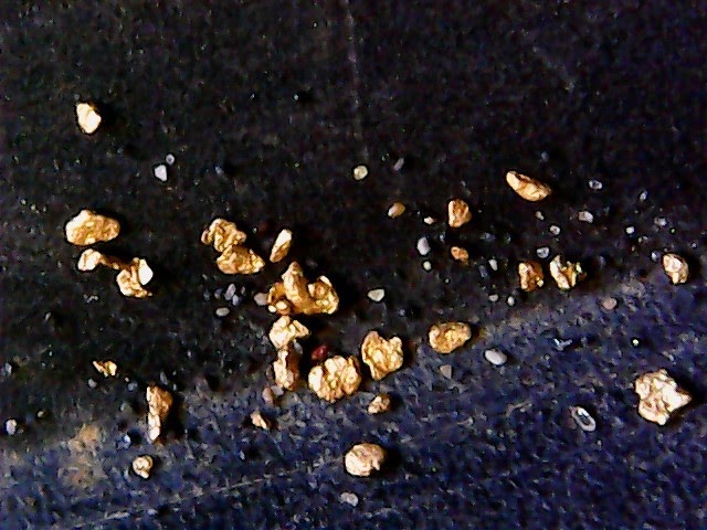
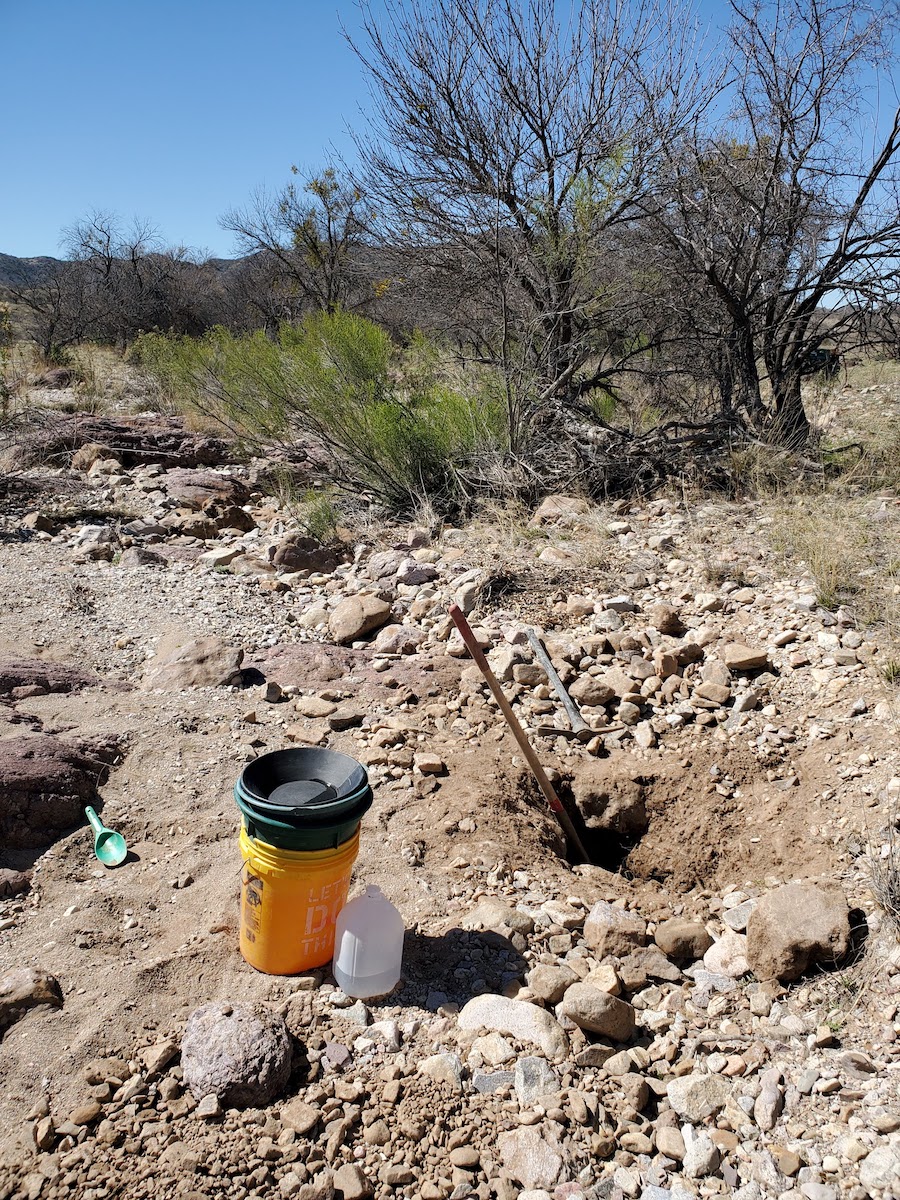
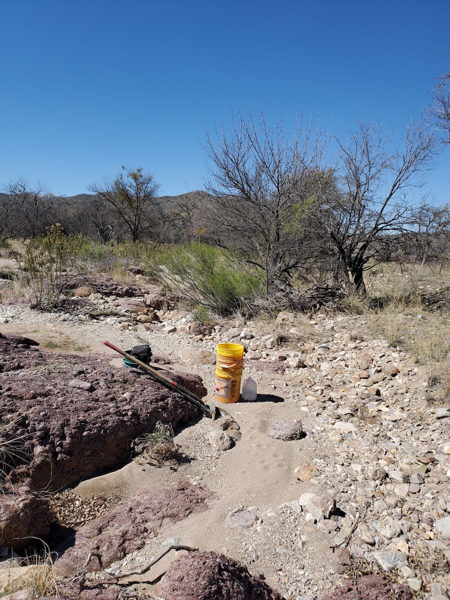
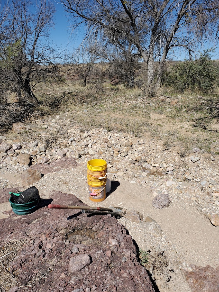
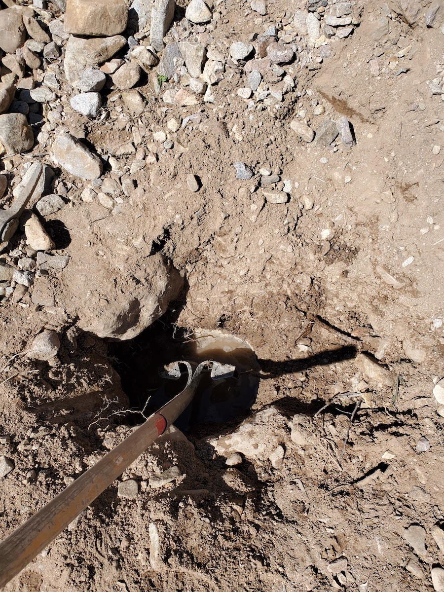
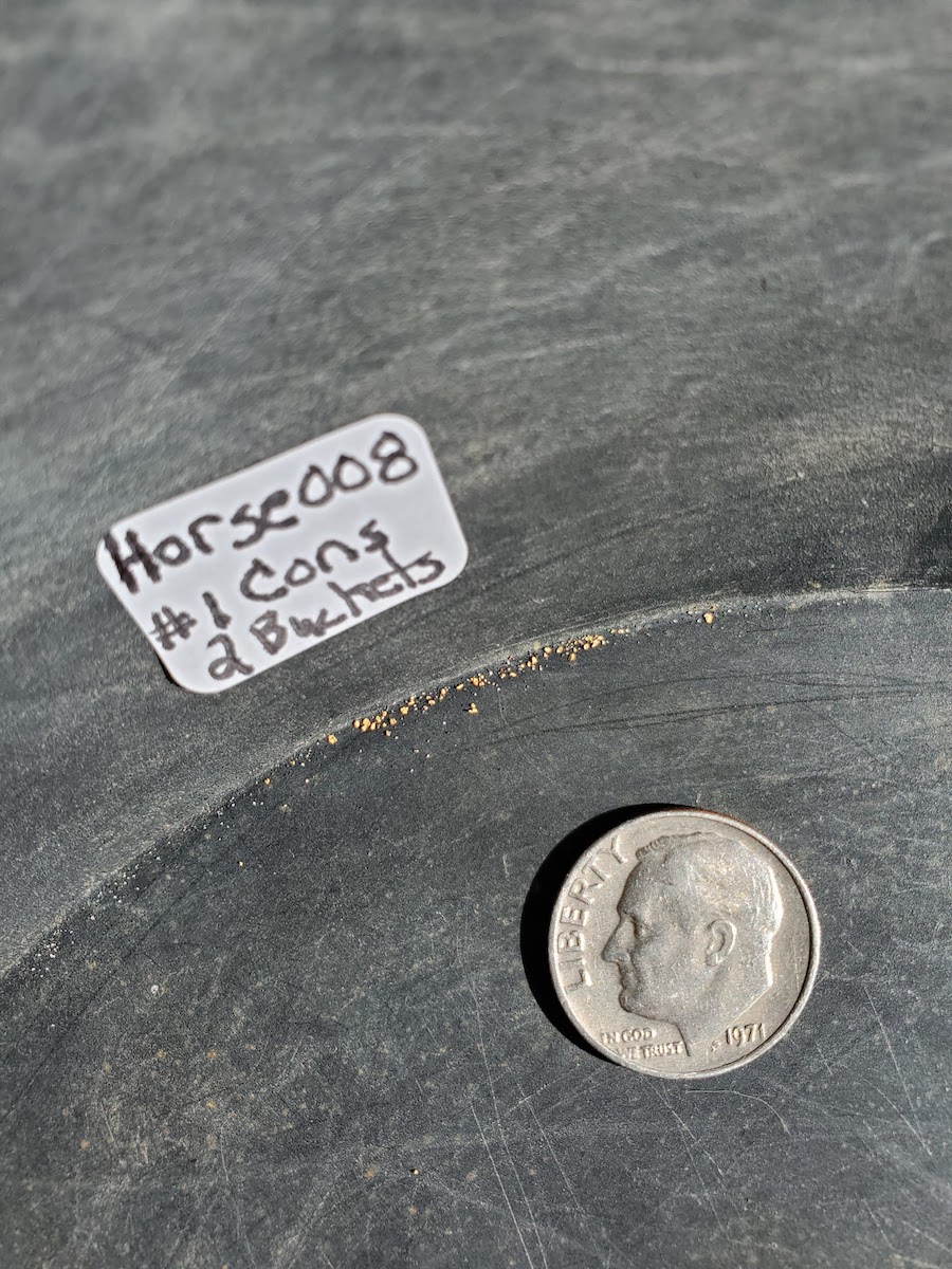
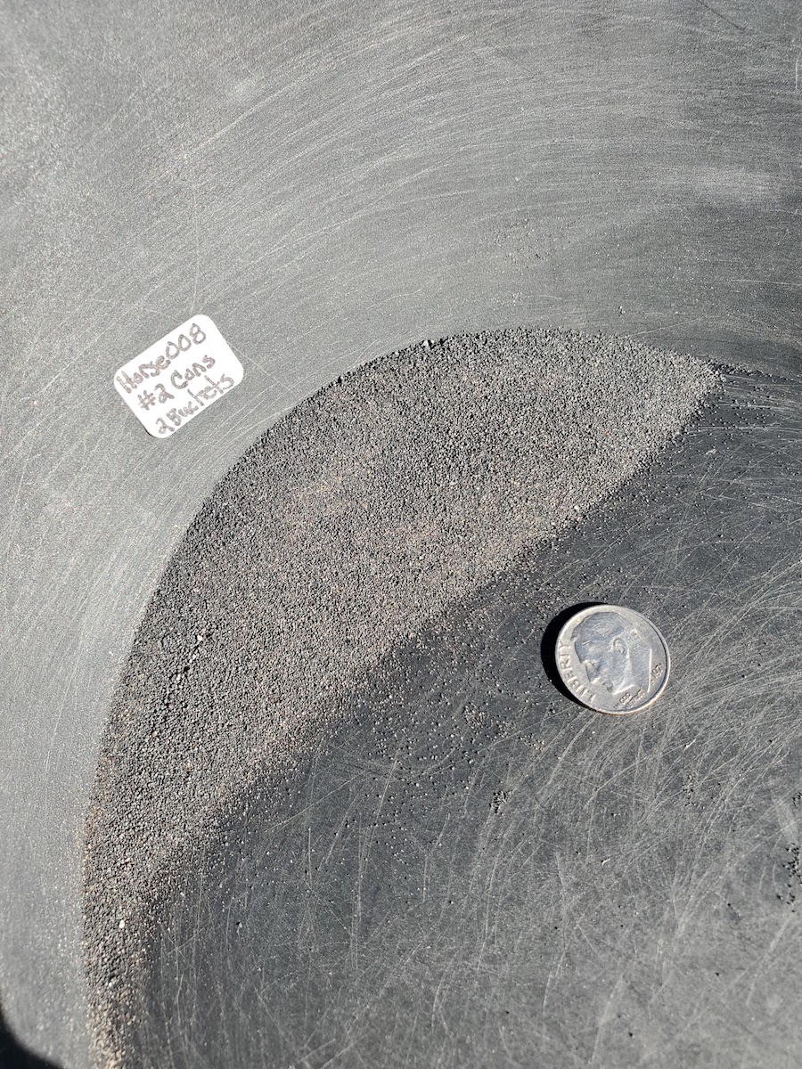
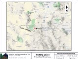
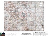
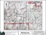
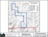
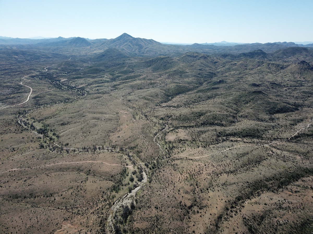
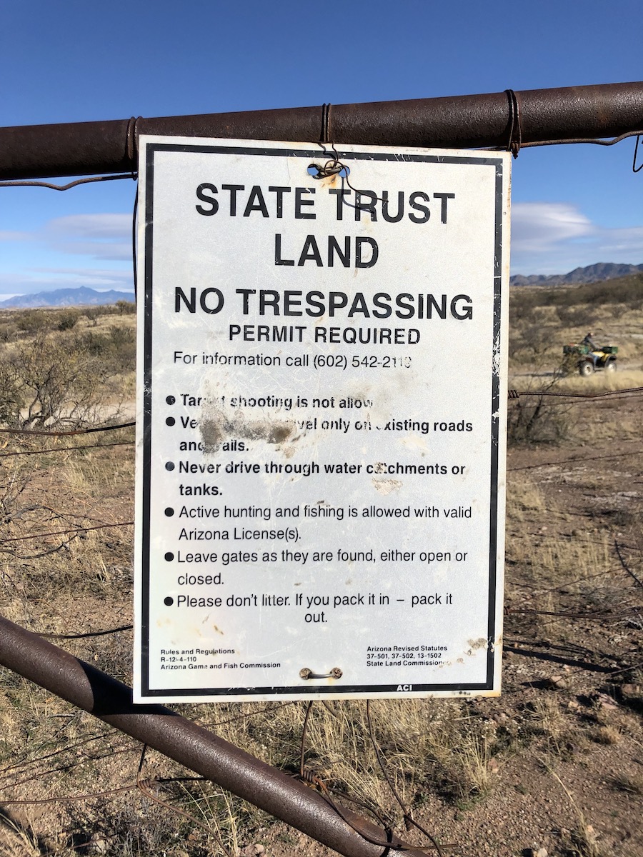
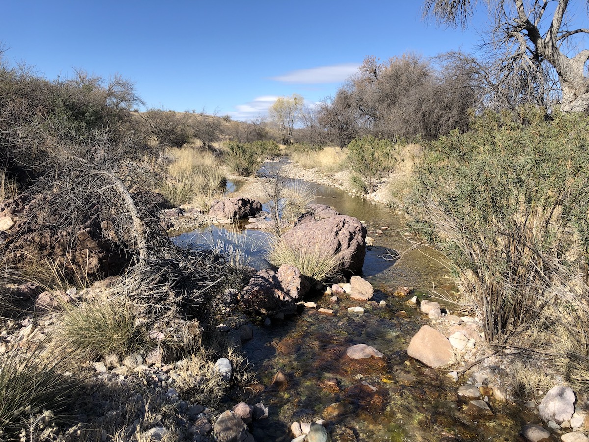
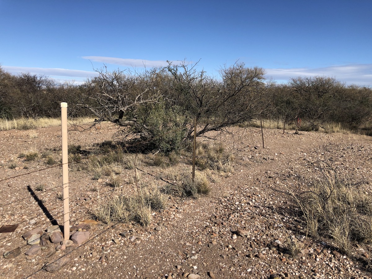
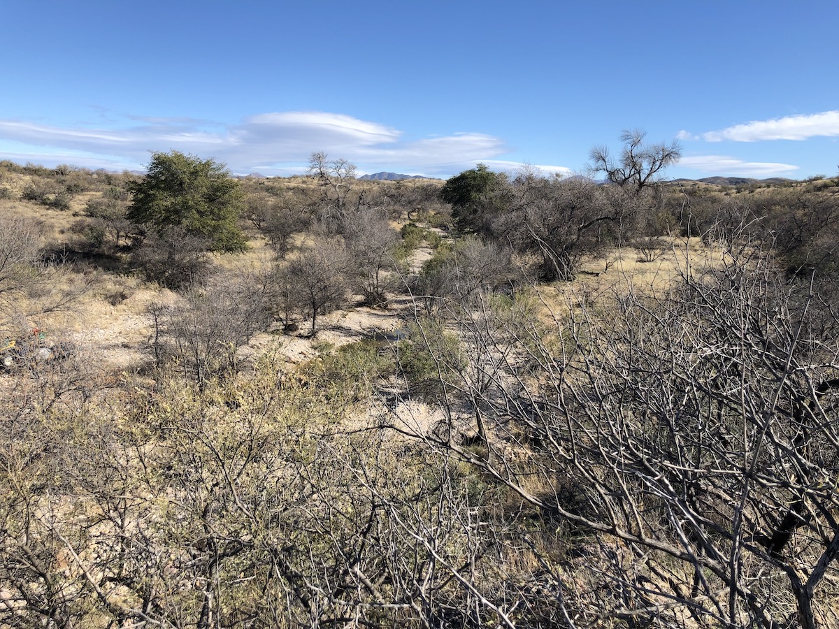
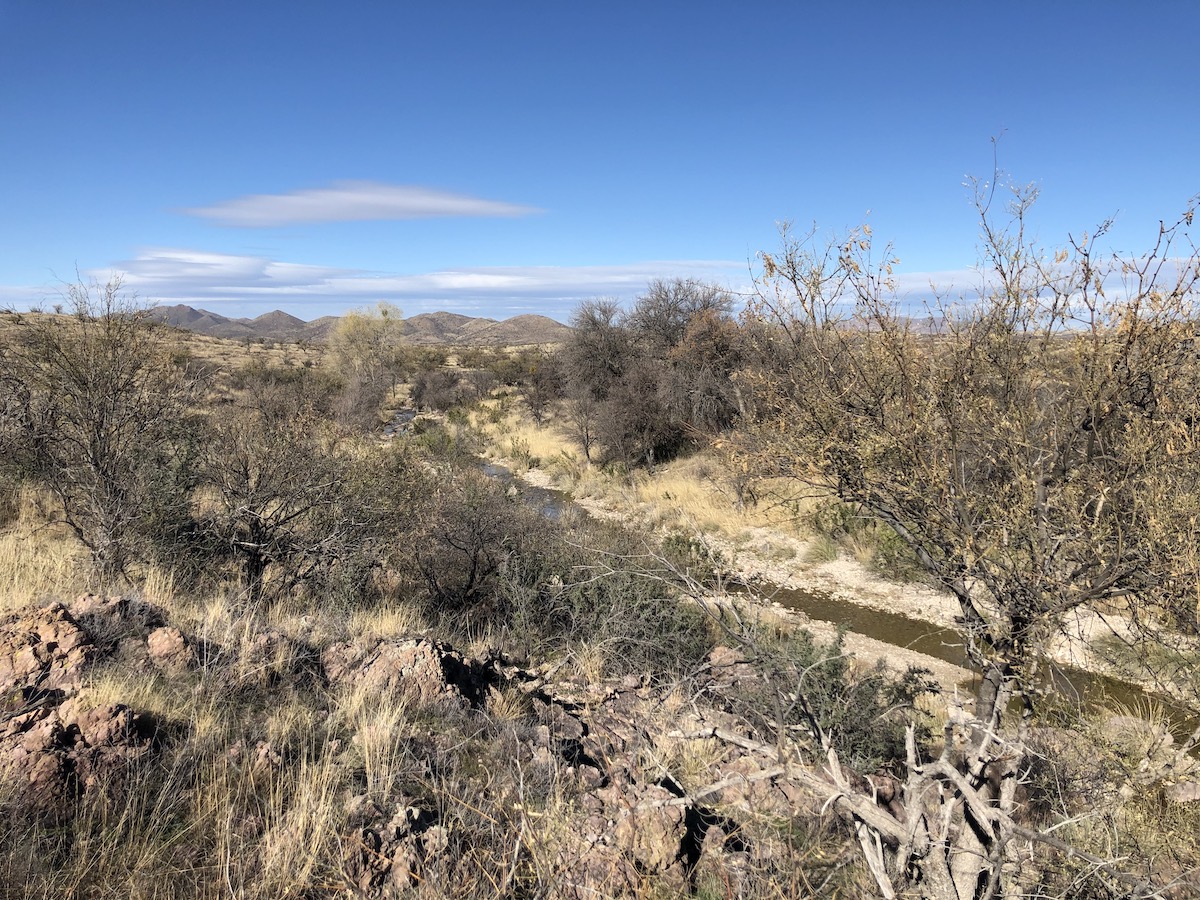
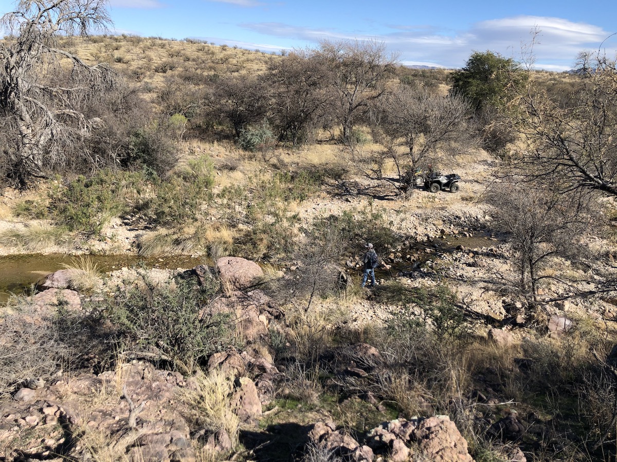
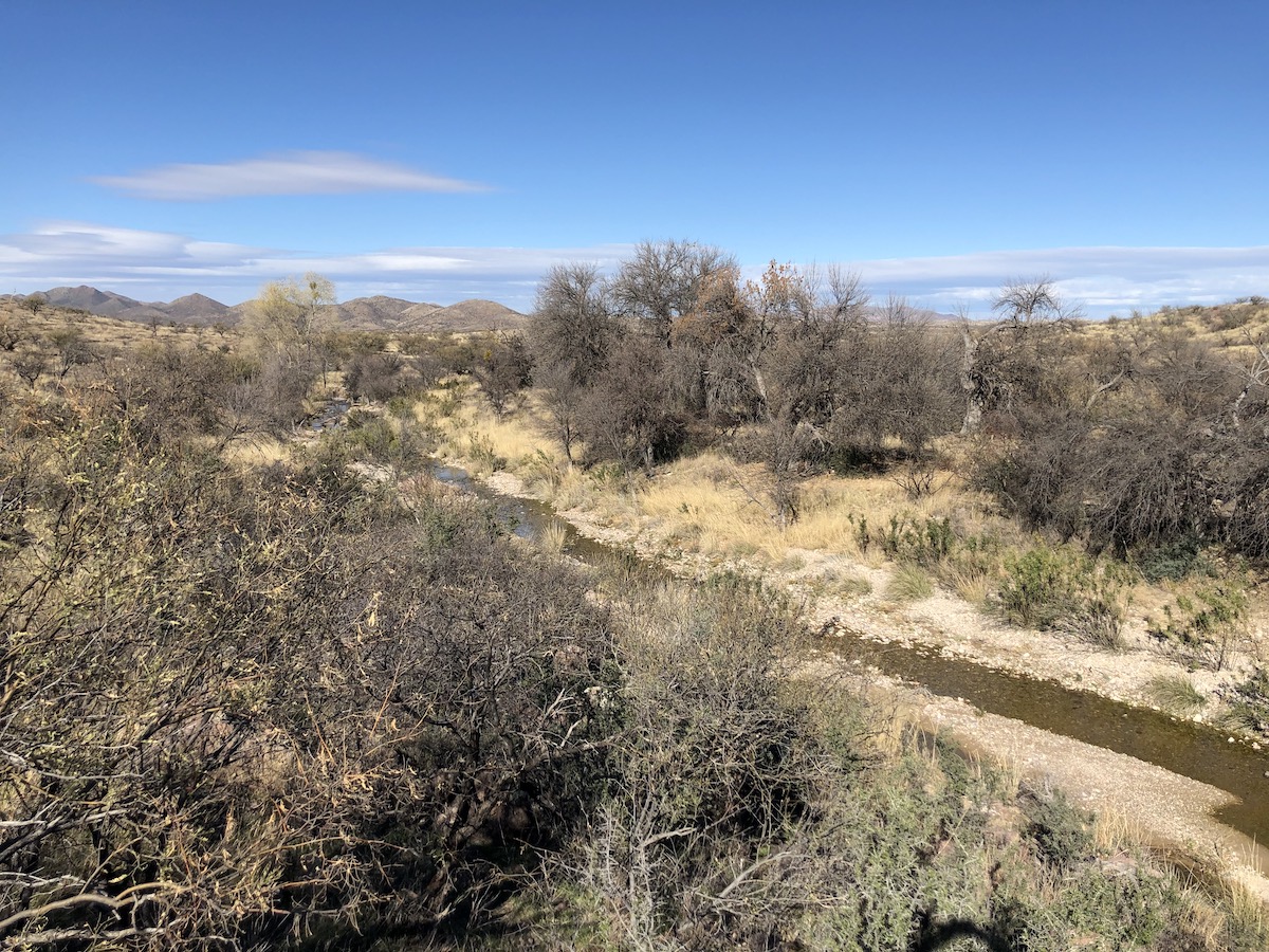
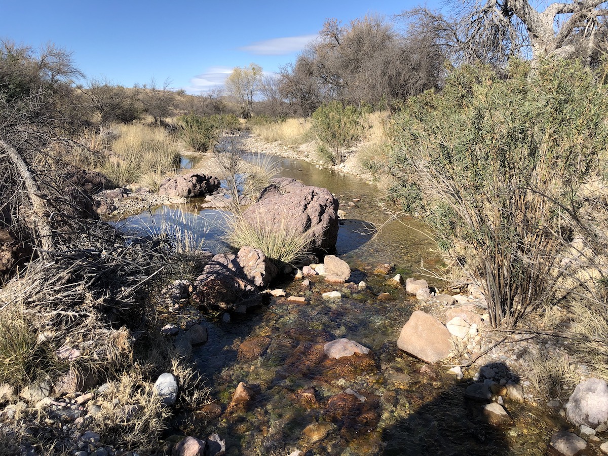
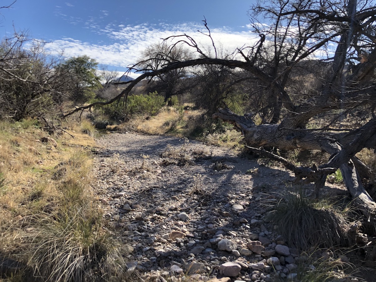
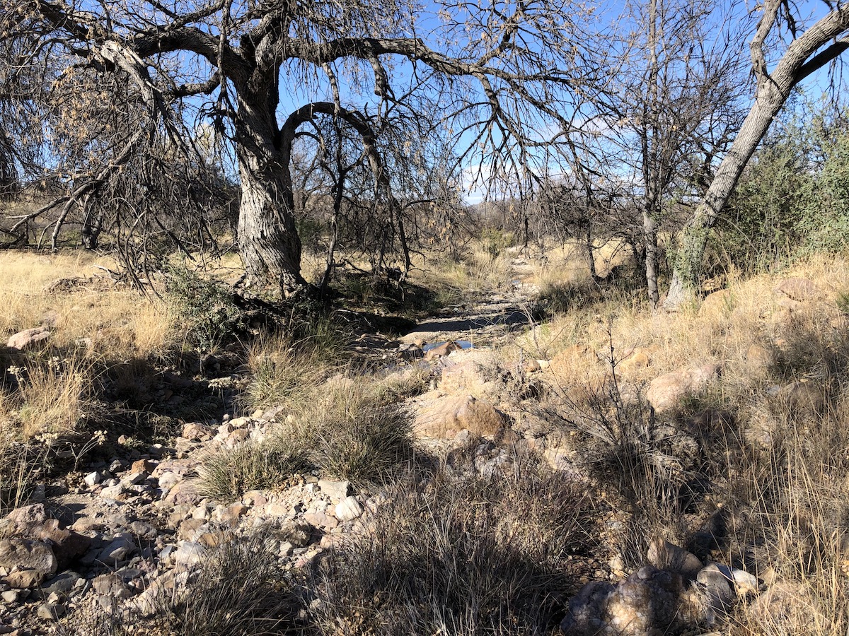
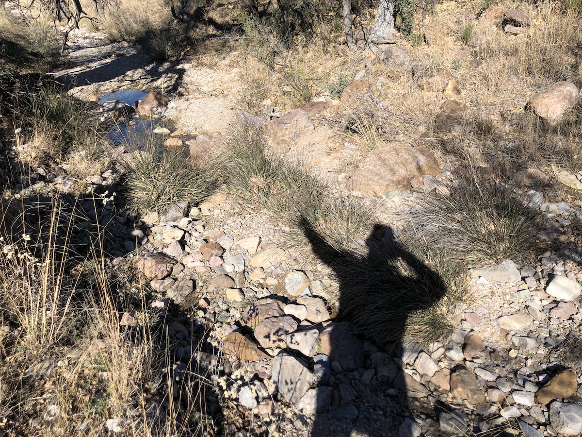
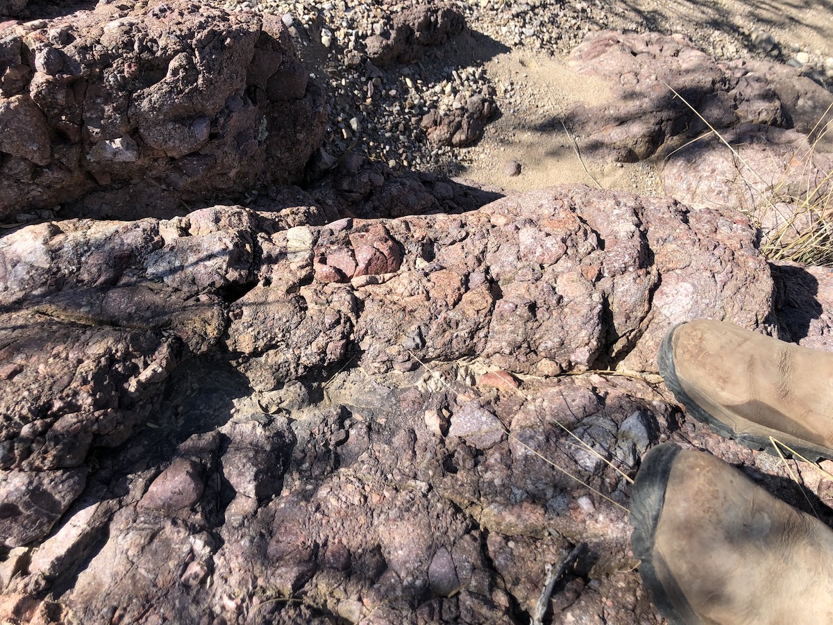
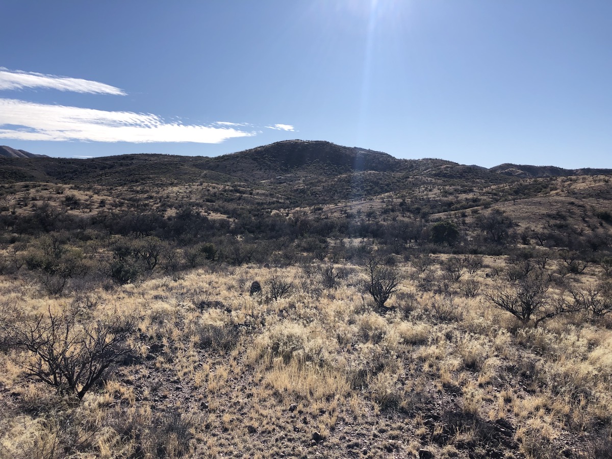
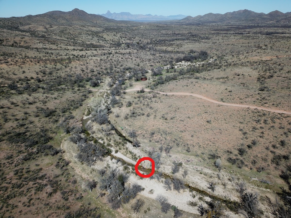
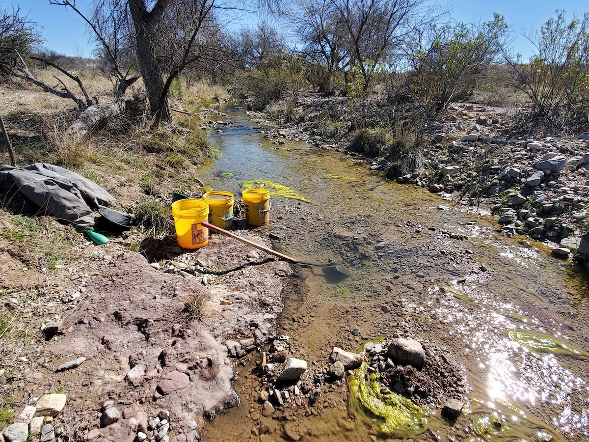
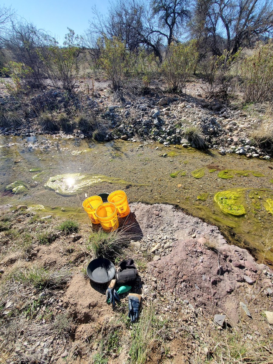
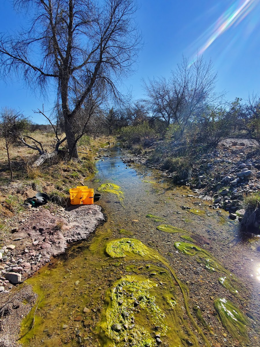
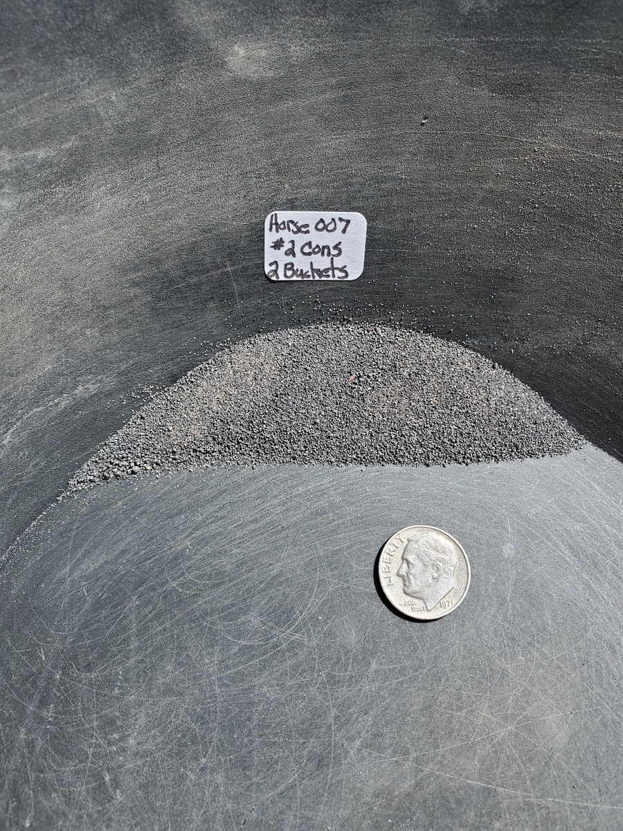
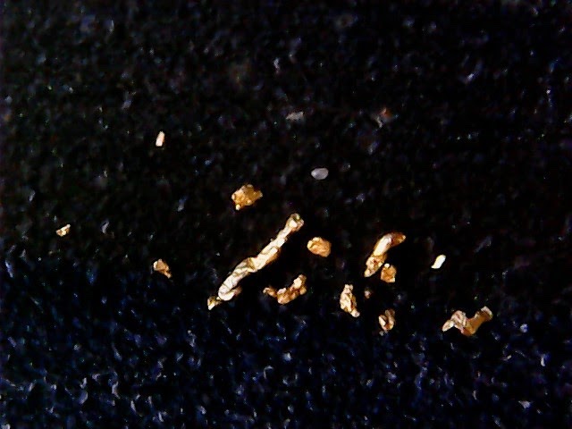
Advanced Geologic and Ajax Placers, LLC are pleased to announce their Mustang Project on Arizona State lands in southern Arizona near Arivaca. Numerous gold-bearing quartz veins that crop out in the San Luis Mountains have created rich placer opportunities down valley in the Fraguita Wash. The first Spanish explorers and settlers in the late 1600’s and early 1700’s extracted gold from the Fraguita Wash gravels and eventually worked their way up valley to find the lode deposits. The pre-1900’s production records indicate more than 350 ounces of gold were recovered from the placers, which is probably significantly underestimated considering the scant accounts and shoddy record keeping at the time. Moreover, the activities were all performed by hand. There is a report of a sand and gravel operation further down valley near Arivaca Wash that may have had a gold recovery circuit. The Fraguita Wash flows from the San Luis Mountains northward where it intersects with the Arivaca Wash west of town. Surface water flows most of the year in the Fraguita Wash, except for last mile where it flows mostly underground. Flash floods from summer monsoons will often cause both washes to flow continuously. The productive portions of the Fraguita Wash are in Section 5 (T. 22N, R. 10E), which is National Forest Service lands, and Section 32 (T 21N, R. 10E), which is Arizona State lands. Section 5 is secured by our Horse Claim Group and Section 32 is secured by our Mustang State Mineral Lease. The Mustang State Mineral Lease secures over a mile of the Fraguita Wash. There are four tributaries to the main wash on the Mustang Lease, three of which are known gold-bearing washes. Along with the gold coming down wash from Section 5 and further south, this creates an excellent opportunity for a significant mineral resource on the Mustang Lease. Satellite and drone photos suggest the activities were strictly contained in the active wash that contained ample water. There are no tailings piles or large excavation pits within the Fraguita Wash nor on the remnant terrace deposits. This suggests that the gravel deposits on the State lands has not been mined. Gravel thicknesses vary across and down the wash. In some places, the bedrock is exposed at the surface and water runs across it and in others places it appears to be more than 20 feet deep. Bedrock is hard meta-sedimentary and meta-volcanic rock, with granite cropping out in the San Luis Mountains. The bedrock is highly fractured in places, forming significant gold traps. There appear to be deep depressions and troughs where gravels and gold have collected. Preliminary tests of 2 – 4 bucket-samples recovered anywhere from a few to several specks and flakes. No bulk samples tests have been conducted as of yet. There is abundant black sand that hampers standard recovery methods and one must be cleaver to overcome this issue. Random assays show the black sand contains gold and silver, so save this precious material. The Mustang Lease is ideal for a small to medium-sized placer operation, utilizing a backhoe or excavator and a small to medium-sized wash plant. With so much subsurface water flow and the hardness to the bedrock, the nooks and crannies of the bedrock would have to be dredged to make sure all the gold on bedrock was recovered. The Mustang Lease is also an ideal place for nugget shooting and a one-man highbanker or suction dredge operation. Advanced Geologic and Ajax Placers, LLC will facilitate the smooth transfer of this lease into your name. Exploration and small mining permits and reclamation bonds will be required and are included in the cost schedule below. An annual report is required that outlines the exploration and testing activities and discloses the amount of gold that was recovered. The State garnishes 10% of the value of the recovered gold in US dollars. Upon request, Advanced Geologic can assist in preparing the annual technical report to the State. The price for the mineral rights to Mustang Arizona State mineral lease is $85,000, which includes the following:
Specific Lease Attributes
Specific Lands Attributes
Estimated GPS Coordinates:
Click here Google Earth Fly To and see an aerial photo of the Mustang and the claim boundaries. Location:
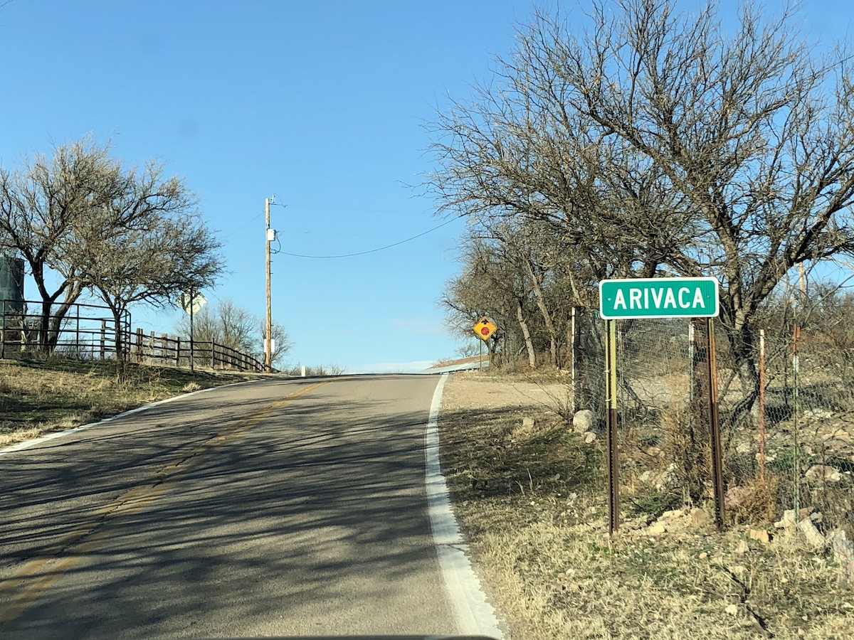
Arivaca is an unincorporated community in Pima County, Arizona. It is located 11 miles north of the Mexican border and 35 miles northwest of the port of entry at Nogales. Arivaca Road connects with I-19 at Amado about 23 miles to the northeast. It is another 33 miles north from Amado to reach Tucson or 29 miles south to reach Nogales. The elevation of Arivaca is approximately 3,643 feet and the population is roughly 900. Weather: At an elevation of 3,643 feet and positioned to capture weather rolling in from the South and West the climate is cooler and wetter than Tucson with highs ranging in the 100’s and lows into the teens. Rainfall ranges from 12-20 inches per year, most of which occurs during the spectacular summer monsoons. The National Weather Service has established June 15th through September 30th as the official monsoon season for the state. Arivaca has a semi-arid climate. History: The European-American history of the area dates back at least to 1695, although the community was not founded until 1878. Between 1916-1921, the U.S. Army maintained a presence in the Arizona border town of Arivaca. Initially there to protect the area from Pancho Villa during the Mexican Revolution, the Army remained to patrol the Mexican border during the first World War. The historic Arivaca mining district consists of over 100 old mines in the Las Guijas Mountains to the Northwest, the San Luis Mountains to the Southwest, and the Cobre Ridge to the Southeast of the town. Gold, silver, lead, copper and tungsten production has been recorded starting in Spanish colonial times and continuing intermittently through the 1950’s. The Oro Blanco Mining District itself had a total gold production estimated to be 126,500 oz of gold. Arivaca had a small population until the Tri Electric Cooperative power lines arrived in the valley in 1956. In 1972 Arivaca Ranch sold 11,000 acres to a land developer who subdivided the property into 40-acre parcels. Four years later, the dirt Arivaca Road was paved. In the 1980's and 1990's a small surge of people moved into the area, a medical clinic, fire department, arts council, human resource office, community center and a branch of Pima County Public Library were opened. The Arivaca district was one of the earliest areas in Arizona to be prospected and worked. The first Spanish explorers and settlers, in the late 1600's and early 1700's, extracted gold from the placers and mined the superficially enriched, weathered veins for gold and silver. Intermittent, small-scale mining continued in the succeeding years with reductions works located at Arivaca where water was available. The main deterrents were hostile Indian and bandit raids in the 1800's. The presence of tungsten was recognized in the early 1900's but not mined until World World I. The greatest activity in the district took place from the early 1930's to the early 1940's, when at least 100 prospectors and small miners eked out a living from working the gold placers and spotty vein deposits for gold and silver, as well as some tungsten. In 1935 there were over 35 small producing mines and prospects, mostly yielding a few tons of ore for the year. Since 1941 there has been only sporadic mining activity with little or no production.
Standard Information Advanced Geologic is a professional geologic consulting firm located in Chester, California. We not only sell quality mining claims, but we also help people work their claims. Our experience in resource evaluations, compliance and permitting and claim portfolio management allows our clients and buyers to go for the GOLD. Interested? Send us an email or call.
|
|
||||||||||||||||||||||||||||||||||||||||||||||||||||||||||
|
|
||||||||||||||||||||||||||||||||||||||||||||||||||||||||||||
|
|