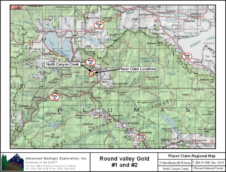
Round Valley Gold #1 & #2
Placer Mining Claim
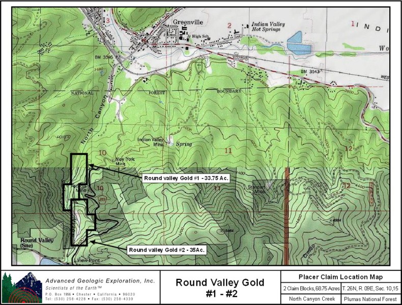
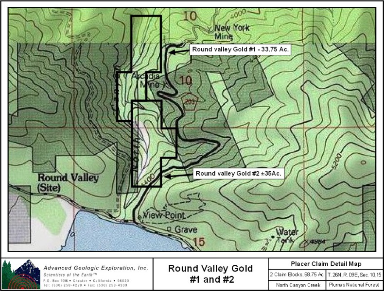
±68.75 Acres
CAMC297984 & CAMC297985
Price: $5,500
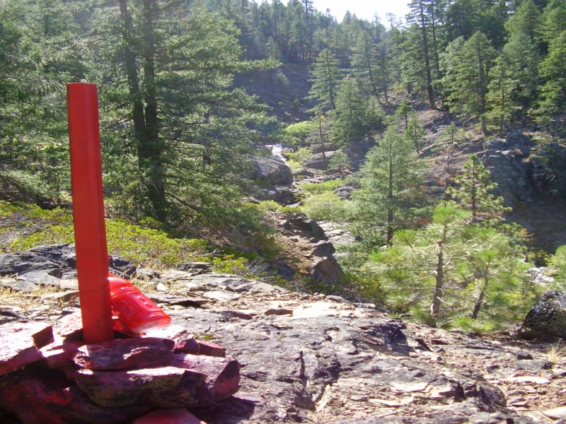
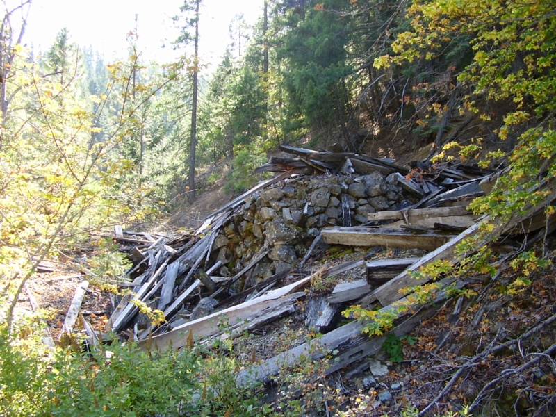
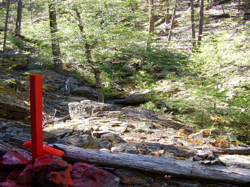
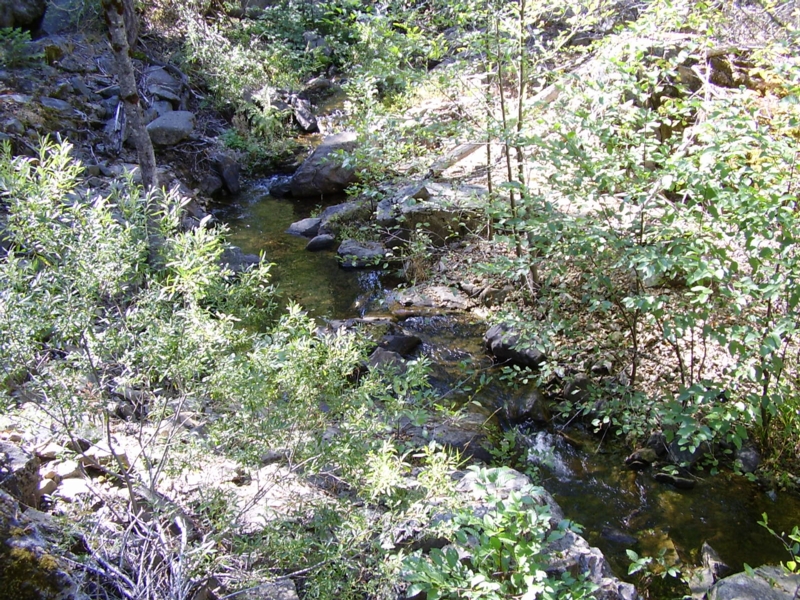
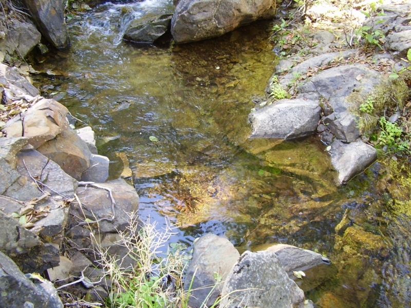
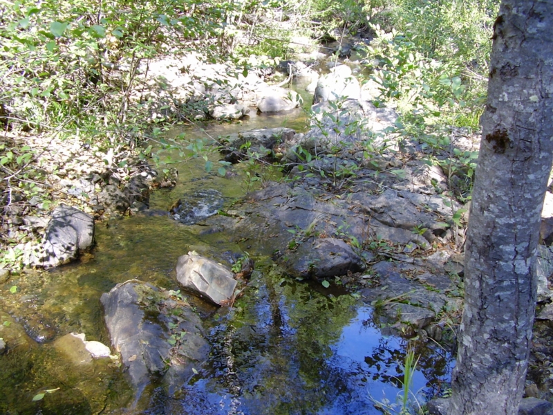
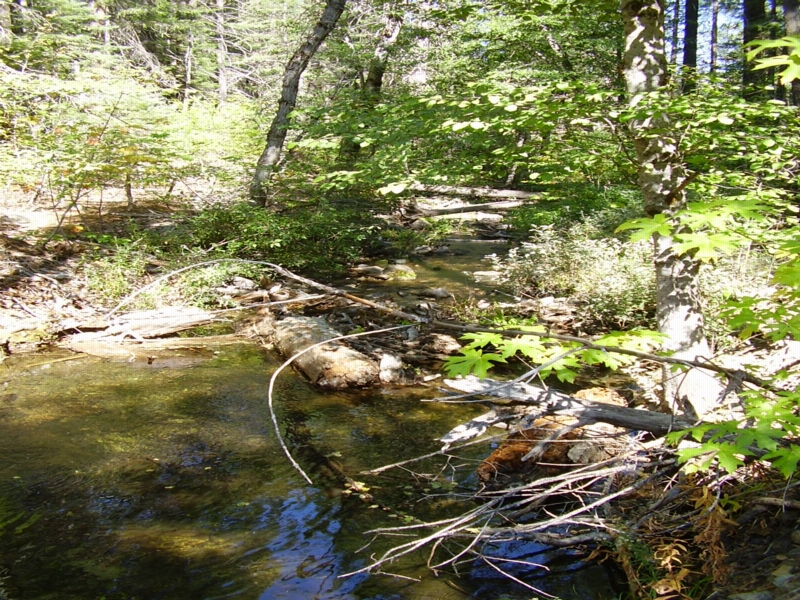
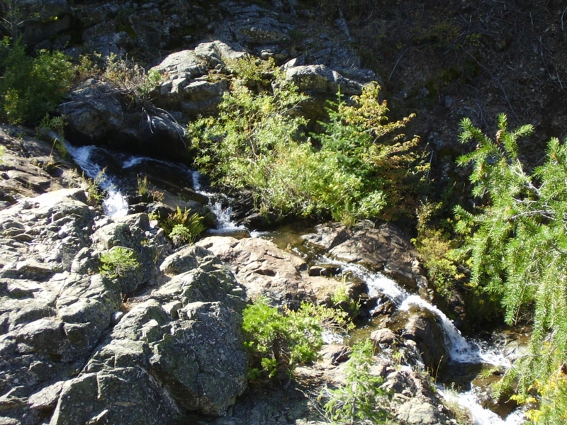
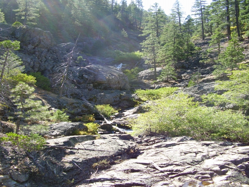
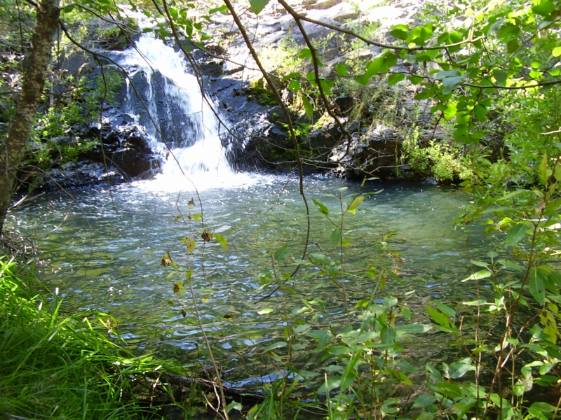
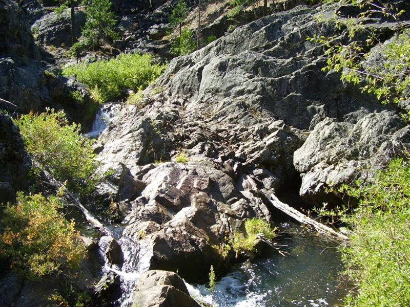
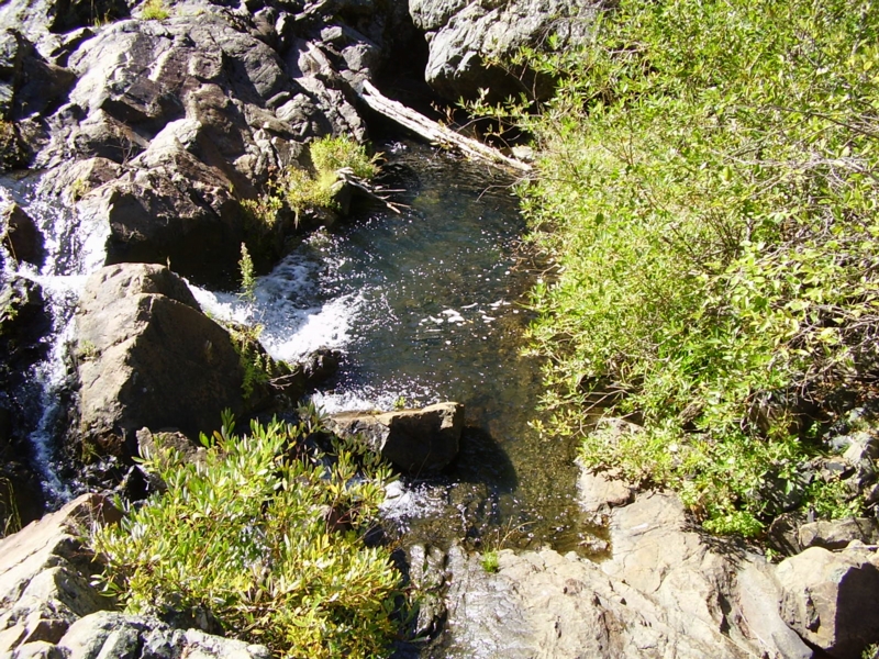
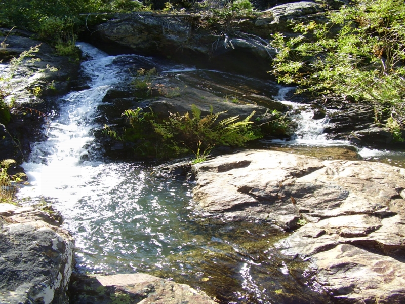
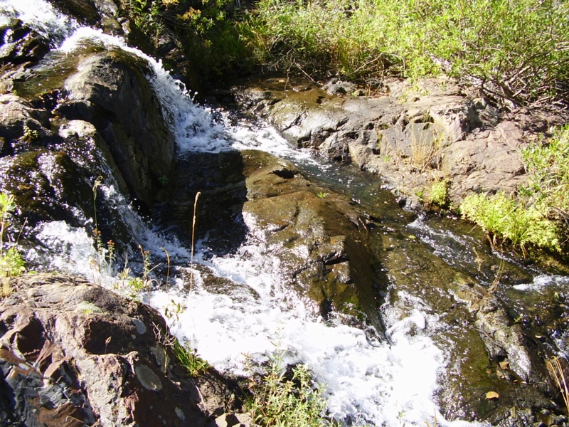
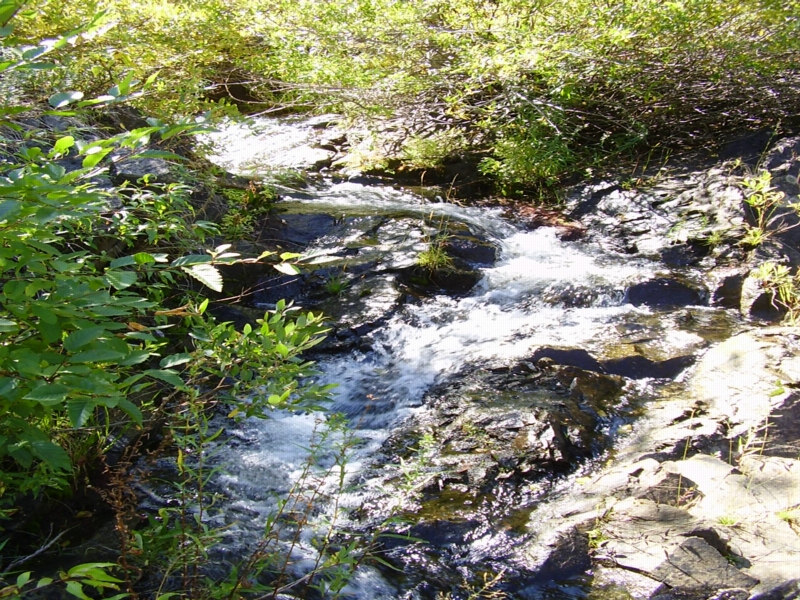
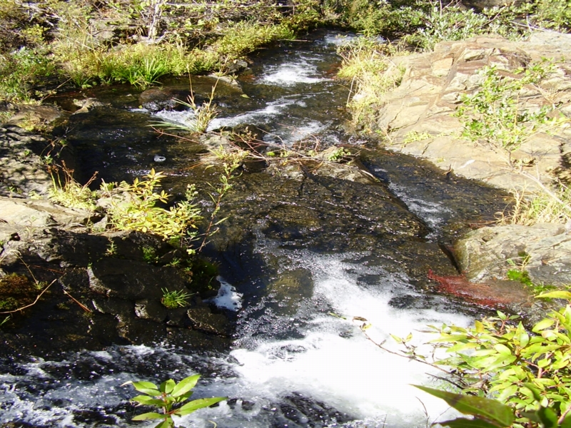
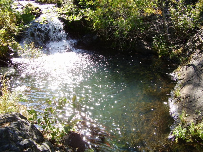
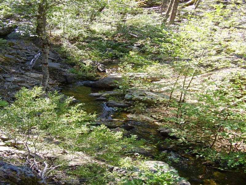
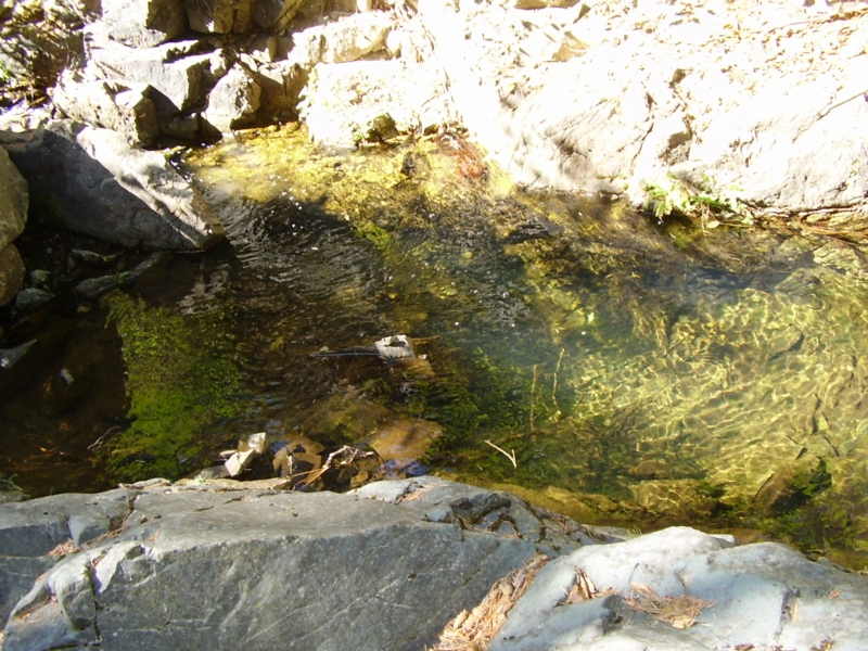
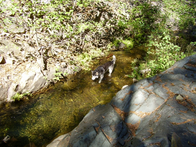
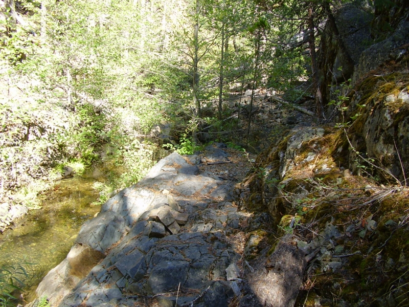
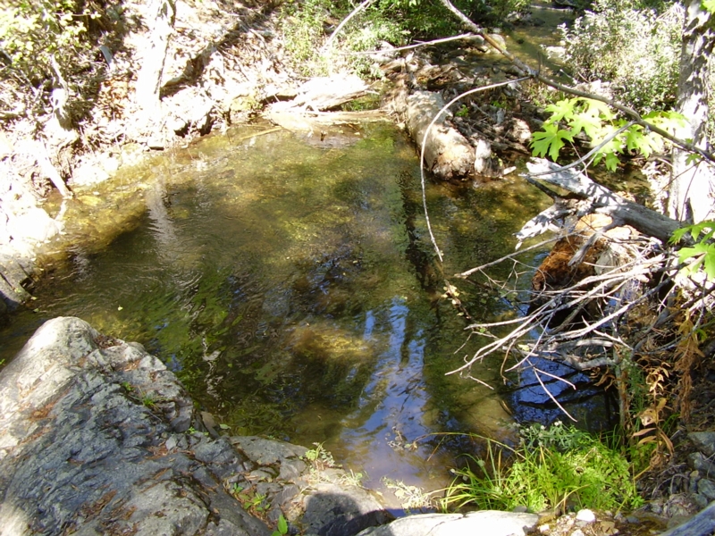
This is a beautiful creek with great potential for panning, sluicing, and metal detecting. Many falls and pools make up this section of the creek which flows year-round. Bedrock is abundant with many traps consisting of roots, cracks, and gravel deposits. The claims are bordered on both uphill sides by patented land.
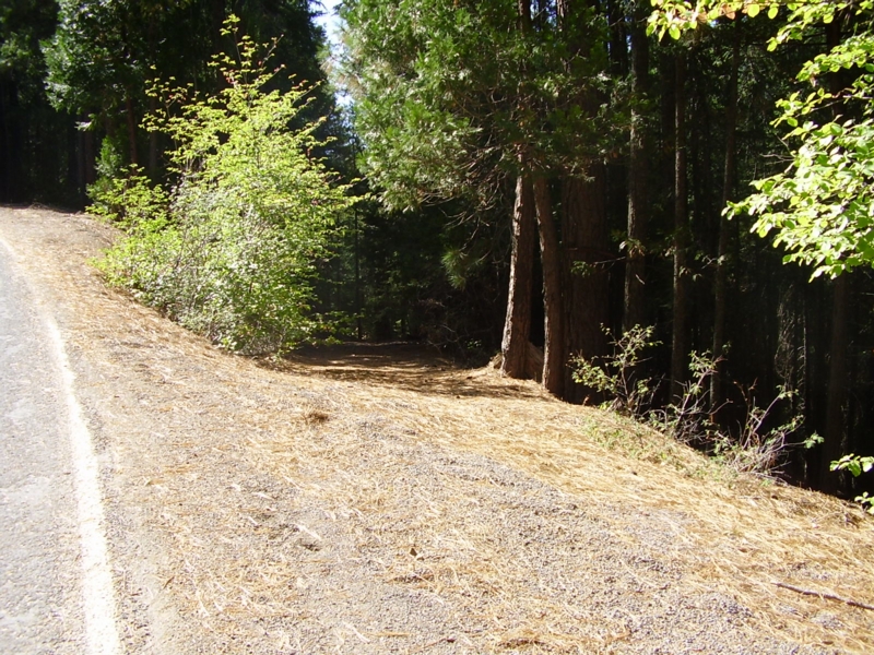
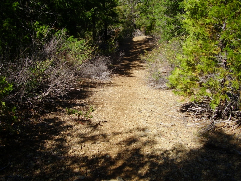
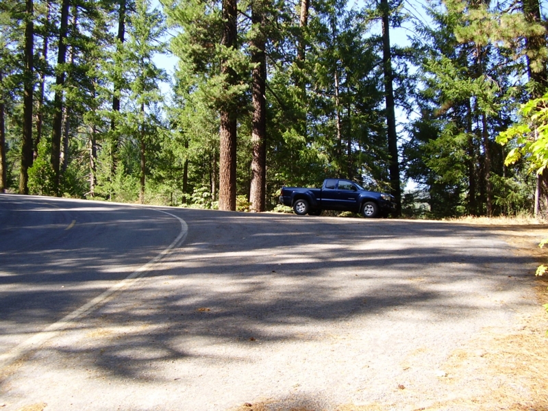
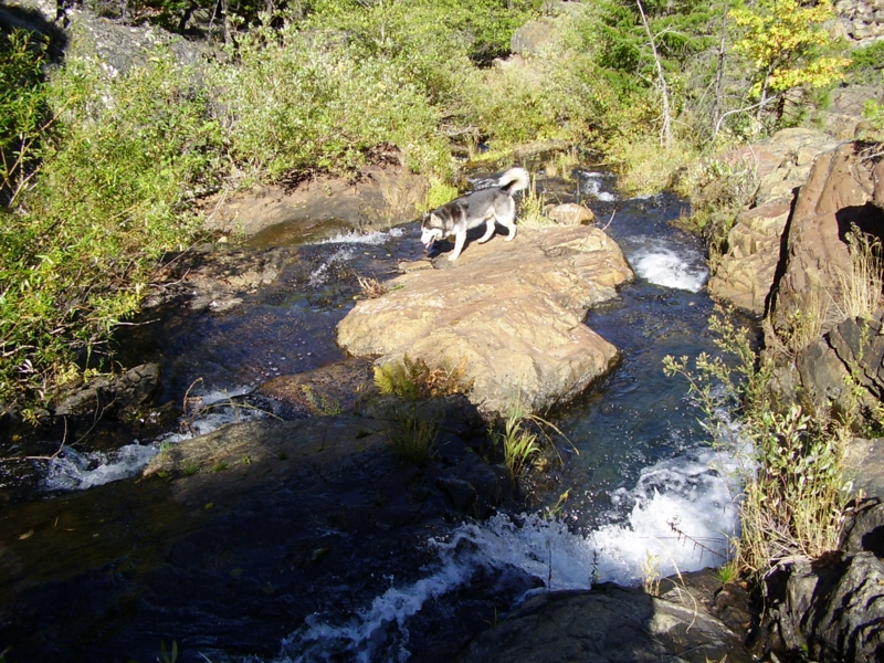
Access to the claims is by Round Valley Road which is paved. A nice trail provides quad or walking access to the creek. There is a campground at nearby Round Valley Lake and RV camping is available in numerous areas within close proximity. Summertime temperatures here range from night time lows in the 50s to day time highs in the 90s.
Don’t forget your swimsuit!
- 2wd access on paved road, short hike to creek.
- Easy trail access to river.
- Local gravels on bedrock. Many, many bedrock exposures!
- Serpentine bedrock - highly fractured/sheared.
- Small to moderately-sized gravel bars.
- Cascading waterfalls and pools.
- Some remnant terraces.
- Tree roots & grass clumps, downed trees, logs, etc.
- Medium to shallow water.
- Wide pull-outs on road, nearby camping.
- Mining level: Recreational to intermediate.
- Quiet and safe area; very beautiful.
- Children and senior friendly - fun for all!
- Greenville is 1.5 miles away with a grocery store and a gasoline facility.
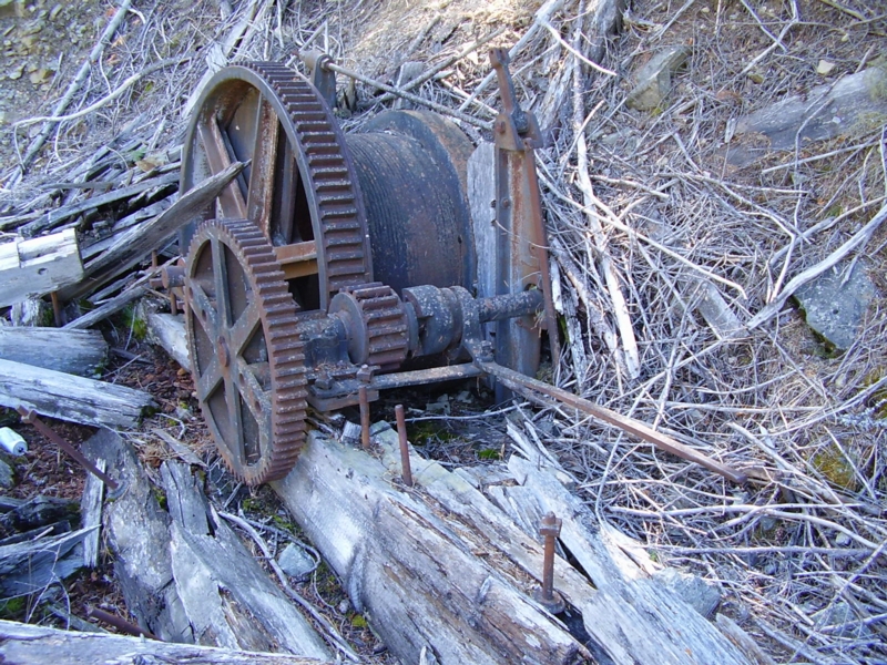
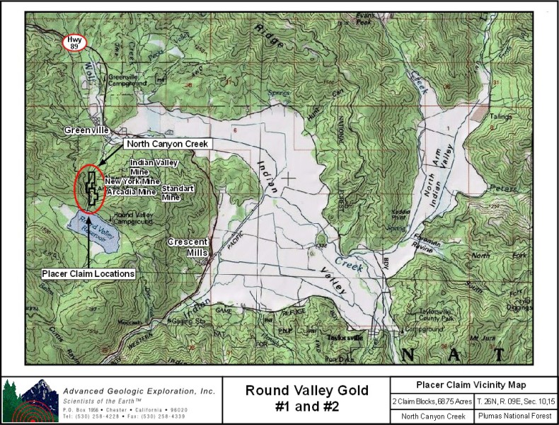
Location: This district is in north-central Plumas County. It contains a northwest-trending belt of lode and placer deposits that extends from the vicinity of the town of Crescent Mills northwest through Greenville to Almanor, a distance of about 10 miles. At one time it was also known as the Cherokee district. Crescent Mills has been the most productive of the districts in the northern end of the Sierra Nevada.
Geology: This area is underlain by a series of northwest-trending beds of Paleozoic and Mesozoic metamorphic rocks. They are: pre-Devonian metaphyolite; Silurain metasedimentary rocks; Taylorsville Formation (Devonian) slate and sandstone; Taylor (Carbonferous to Permian) metasedimentary rocks (four formations); greenstones (Carboniferous); Triassic metasedimentary rocks; Jurassic granodiorite and serpentinized basic and ultra-basic intrusives. Overlying the bedrock are patches of Tertiary and Quarternary gravels.
Ore Deposits: A number of northwest-striking quartz veins occur principally in the greenstones, slates, and granodiorite. Some of the veins are as much as 20 feet thick. The ore contains free gold, auriferous pyrite, and smaller amounts of other sulfides. The surface ores were especially rich, and numerous highgrade pockets were encountered during the early days. Milling-grade ore usually contained slightly less than 1/4 ounce per ton, but the ore shoots had stoping lengths of up to 300 feet. Iron and copper also occur in the district.
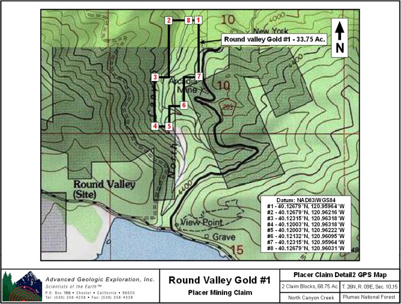
Google Earth Fly To view Round Valley Gold #1 and its claim bounderies.
Google map it for directions to the claim.
Pinpoint is on North Canyon Creek.
Estimated GPS Coordinates:
Round Valley Gold #1
Please adjust GPS to the following Datum & Coordinate display:
Datum: NAD83/WGS84
Coordinates: UTM
|
Easting
|
Northing
|
Elevation
|
| Northeast Corner Boundary: |
|
673848mE
|
4443825mN
|
3828 ft.
|
| Northwest Corner Boundary: |
|
673633mE
|
4443820mN
|
3889 ft.
|
| Outer Western Corner: |
|
673555mE
|
4443414mN
|
3858 ft.
|
| Southwest Corner Boundary: |
|
673563mE
|
4443067mN
|
4000 ft.
|
| Southeast Corner Boundary: |
|
673645mE
|
4443069mN
|
4085 ft.
|
| Lower Eastern Corner: |
|
673750mE
|
4443215mN
|
4086 ft.
|
| Upper Eastern Corner: |
|
673857mE
|
4443421mN
|
4075 ft.
|
| North Canyon Creek @ Northern Boundary: |
|
673791mE
|
4443823mN
|
3762 ft.
|
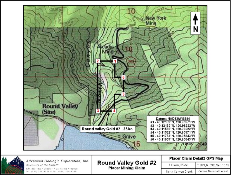
Google Earth Fly To view Round Valley Gold #2 and its claim bounderies.
Google map it for directions to the claim.
Pinpoint is on North Canyon Creek.
Estimated GPS Coordinates:
Round Valley Gold #2
|
Easting
|
Northing
|
Elevation
|
| Northeast Corner Boundary: |
|
673805mE
|
4443216mN
|
4164 ft.
|
| Northwest Corner Boundary: |
|
673642mE
|
4443213mN
|
3994 ft.
|
| Southwest Corner Boundary: |
|
673656mE
|
4442602mN
|
4343 ft.
|
| Southeast Corner Boundary: |
|
673870mE
|
4442607mN
|
4620 ft.
|
| Lower Eastern Corner: |
|
673974mE
|
4442821mN
|
4360 ft.
|
| Access Road @ Upper Eastern Corner: |
|
673969mE
|
4443028mN
|
4309 ft.
|
Standard Information
The Round Valley Gold #1 & #2 placer mining claims are non-patented federal mining claims. Fees are current and you will need to file appropriate paperwork to hold the property every year thereafter. Annual tax assessment on the property is approximately $1.12/acre.
Upon payment, the mineral claim will be transferred via a notarized Quitclaim notice filed in your name with Plumas County and the BLM.
BLM Fees & Advanced Geologic Transfer Fees
Advanced Geologic has an exceptional automatic claim notice filing system that will maintain your annual filings for any claim in the United States. Advanced Geologic reminds you that you MUST file annual notices with both the county in which the claim is located AND with the Bureau of Land Management by the appropriate dates. There are NO exceptions and errors will lead to the loss of your claim! Are your claims filed correctly?
Advanced Geologic is a professional geologic consulting firm located in Chester, California. We not only sell quality mining claims, but we also help people work their claims. Our experience in resource evaluations, compliance and permitting and claim portfolio management allows our clients and buyers to go for the GOLD.
Interested? Send us an email or call.