|
|
| Placer Mining Claims For Sale | ||||||||||||||||||||||||||||||||||||||||||
|
|
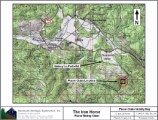
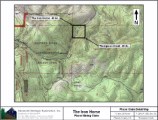
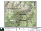
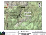
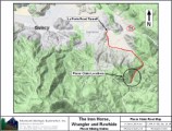
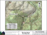
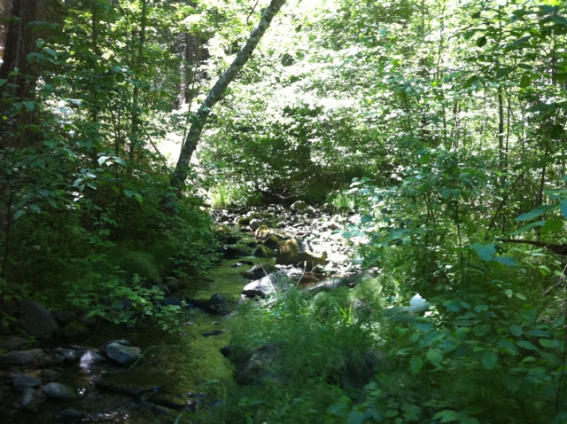
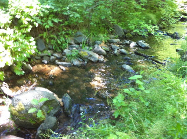
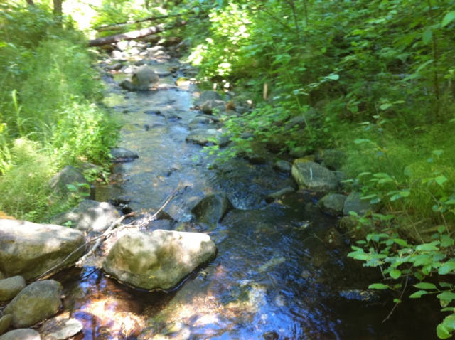
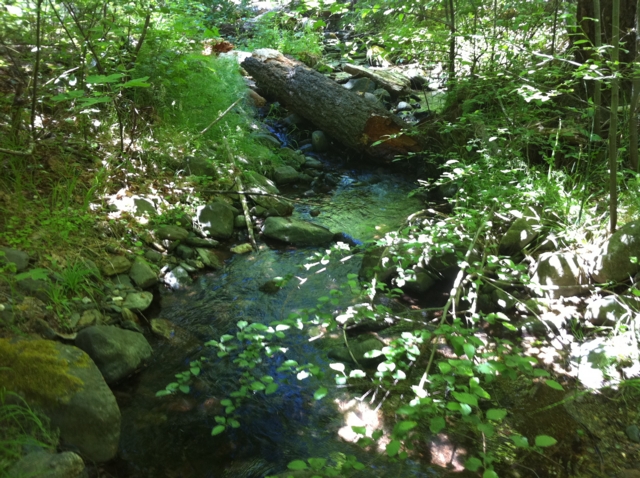
The Iron Horse ±40 Acres Price: $3,000 ALL THREE THOMPSON CREEK CLAIMS: $7,500
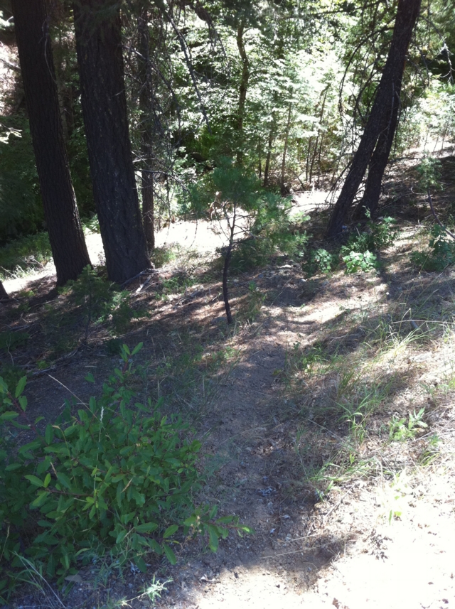
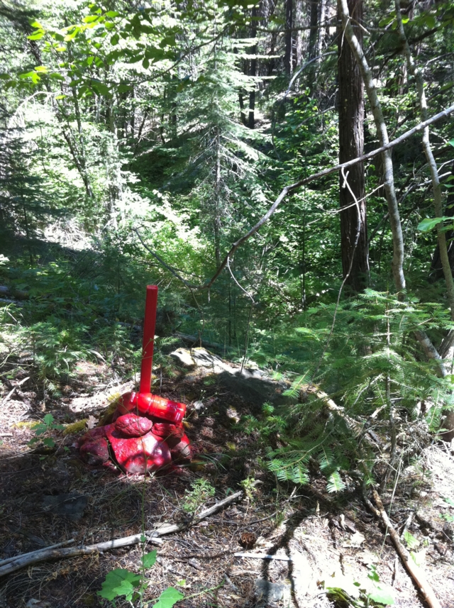
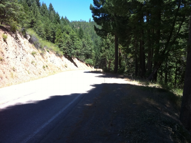
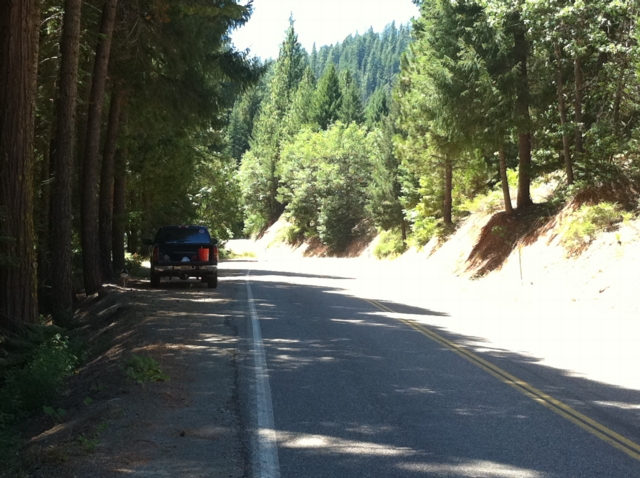
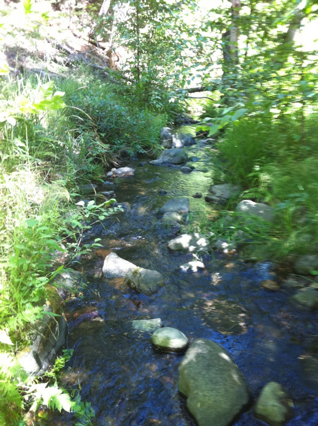
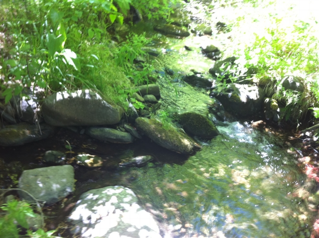
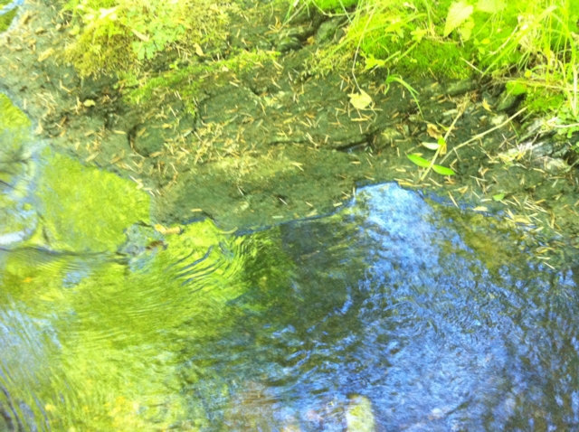
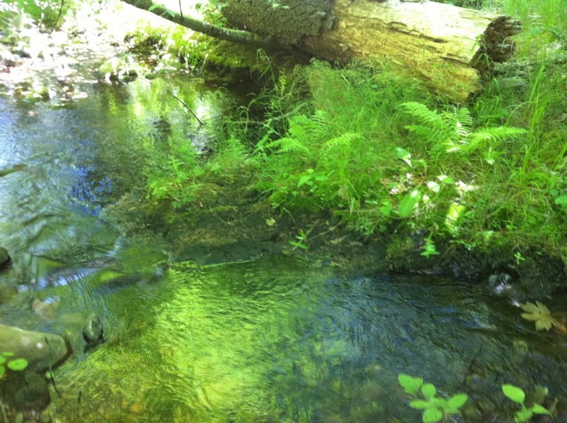
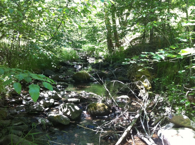
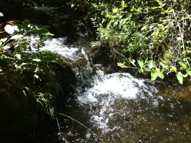
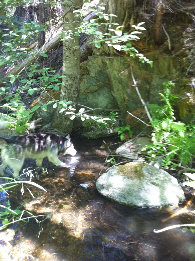
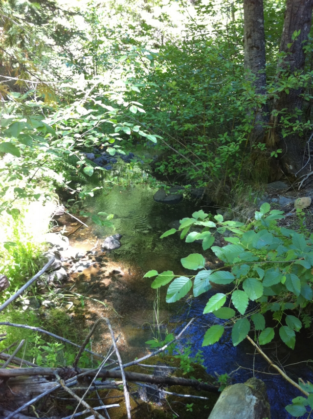
Sometimes prospectors need a break from the high-pace, high skill level claims and just need to have fun. The Iron Horse 40-acre placer mining claim on Thompson Creek provides just that opportunity. With its relatively low, but constant flow, the Iron Horse claim will provide ample opportunities to have fun and find some gold. Iron Horse placer mining claim is located about six miles (as the crow flies) southeast of Quincy along the Quincy-La Porte Road (see vicinity map). The claim is at the sweeping left-hand hairpin corner about five miles up the hill from Highway 89. The GPS coordinates for the intersection of the Quincy-La Porte Road and Thompson Creek is shown below. Thompson Creek drains the rich meta-sedimentary rocks associated with Claremonte Peak and Bachs Creek Ridge, which are legendary for bedrock gold. Thompson Creek also drains Peppard Flat, a large deposit of Tertiary gravels from the ancient Feather River prior to the uplift of the Sierra Nevada. Several placer mining claims are located along Thompson Creek and everyone says the gold is both coarse, like the cereal Grape Nuts (bedrock gold), and rounded (Tertiary placer gold). Grab samples from root masses, moss and cracks revealed several flakes in every pan. The Quincy-La Porte Road bisects the claim into two parts, an upper portion and a lower portion. A large turn out along the road provides ideal staging area for all your prospecting activities as well as RV parking. An improved gravel road provides access to the upper portion of the claim. As the photos show, it is just a short jump down from the road to the water. Prospecting skill levels for The Iron Horse placer claim are from recreational to beginner, because of its shallow depth to bedrock, low water flow, and easy access. Gravels-on-bedrock contacts are widespread and as the photographs show, floodwaters appear and scour the rock every so often to replenish the gravels and the GOLD! With all the cracks and fractures, prospectors with metal detectors should find abundant rewards not only along the stream but along the slopes and within the cliffs. Miners and prospectors will have a life-time of opportunities before this claim is played out. Quincy is just a short drive away and provides good amenities, such as restaurants and accommodations. Quincy also has a modest nightlife, a movie theater, a Safeway and an Ace Hardware, as well as a series of motels and B&Bs. Sorry, no Wal-Mart. Quincy is also the county seat for the county so you can easily file your paperwork on your way through to your claim. Ore deposits: Gold-quartz veins occur principally in slate and mica schist; some are as thick as 15 feet. The veins may be massive or consist of numerous parallel stringers. The ore contains free gold and varying amounts of sulfides, chiefly pyrite. Although some of the veins have been developed for horizontal distances of several thousand feet, none has been worked to depths of greater than a few hundred feet. There are a few small Tertiary channel gravel deposits to the south. The Recent and Pleistocene valley alluvium is gold-bearing in places. Work Cited: “Gold Districts of Click here for Google Earth Fly To to see an aerial photo of the The Iron Horse claim. Google map it for directions to claim. Estimated GPS Coordinates:
Standard Information BLM Fees & Advanced Geologic Transfer Fees Upon payment, the mineral claim will be transferred via a notarized Quitclaim notice filed in your name with Plumas County and the BLM. Limited payment terms and conditions are available; information available on request. Advanced Geologic has an exceptional automatic claim notice filing system that will maintain your annual filings for any claim in the United States. Advanced Geologic reminds you that you MUST file annual notices with both the county in which the claim is located AND with the Bureau of Land Management by the appropriate dates. There are NO exceptions and errors will lead to the loss of your claim! Are your claims filed correctly? Advanced Geologic is a professional geologic consulting firm located in Chester, California. We not only sell quality mining claims, but we also help people work their claims. Our experience in resource evaluations, compliance and permitting and claim portfolio management allows our clients and buyers to go for the GOLD. Interested? Send us an email or call.
|

|
||||||||||||||||||||||||||||||||||||||||
|
Click here to view the slideshow
|
||||||||||||||||||||||||||||||||||||||||||
|
|