|
|
| Placer Mining Claims For Sale | ||||||||||||||||||||||||||||||||||||||||||||||||||||||
|
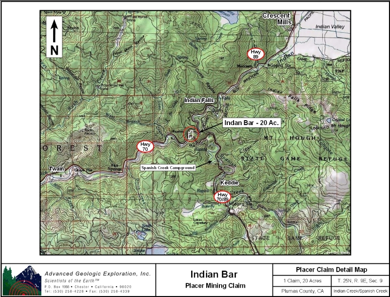
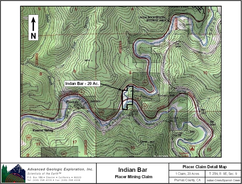
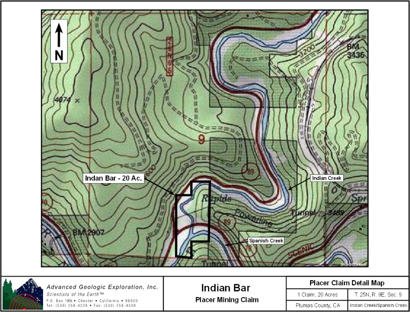
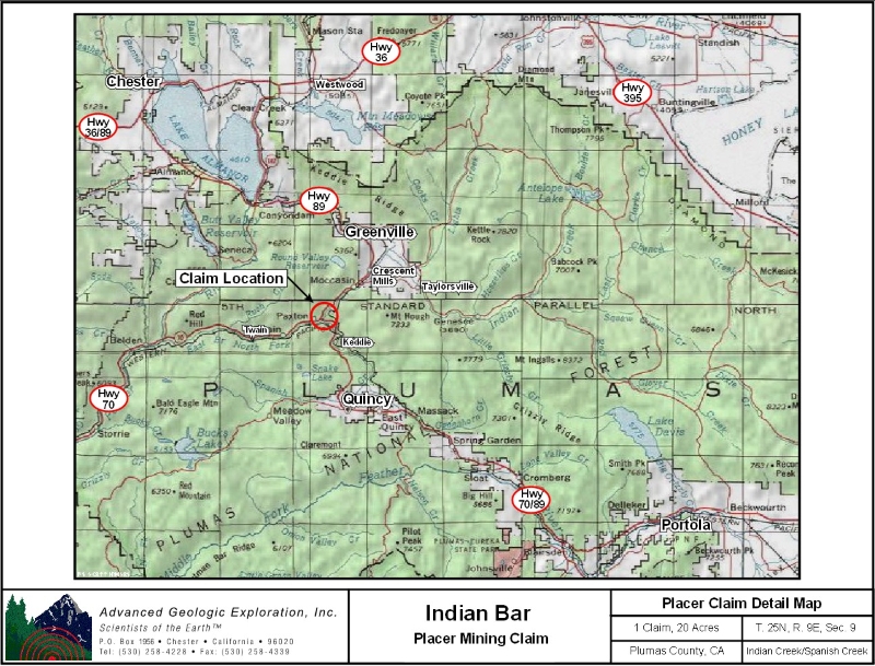
Indian Bar ±20 Acres
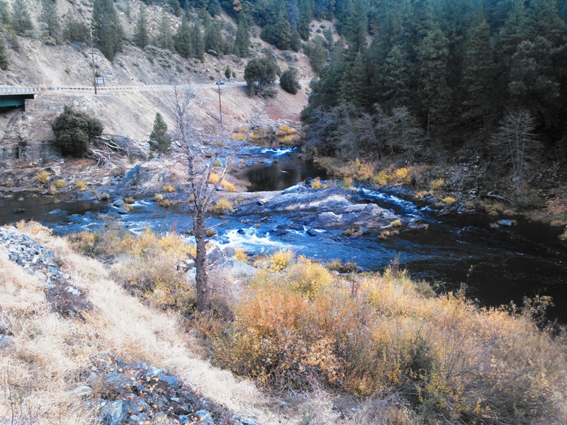
Price: $8,500 Geology: The principal rocks that underlie the district are slate, mica schist, and quartzite. Greenstone lies to the northeast and serpentine to the southwest. American and Thompson Valleys are underlain by Recent and Pleistocene alluvium. A few isolated peaks in the area are capped by basalt. Ore Deposits: Gold-quartz veins occur principaly in slate and mica schist; some are as thick as 15 feet. The veins may be massive or consist of numerous parallel stringers. The ore contains free gold and verying amounts of sulfides, chiefly pyrite. Although some of the veins have been developed for horizontal distances of several thousand feet, none has been worked to depths of greater than a few hundred feet. There are a few small Tertiary channel gravel deposits to the south. The Recent and Pleistocene valley alluvium is gold-bearing in places. Mines: Placer: Bushman, Carr, Cascade, Elizabethtown Flat, Imperial, Manhattan, Mill Creek, Newton Cons., Newton Flat, Riverdale. Lode: Bell, Butterfly, Fairplay, Gold Leaf Cons., King Soloman, St. Nicolas, Tefft, White Oak. Work Cited: “Gold Districts of Some amenities are:
Google map it for directions to claim. Estimated GPS Coordinates:
Standard Information Indian Bar placer mining claim is a non-patented federal mining claim. You will need to file appropriate annual paperwork to hold the property every year. (Ask us about our Filing Service to assist you with that!) Annual property tax assessment is approximately $1.12 an acre. BLM Fees & Advanced Geologic Transfer Fees Upon payment, the mineral claim will be transferred via a notarized Quitclaim notice filed in your name with Butte County and the BLM. Limited payment terms and conditions are available; information available on request. Advanced Geologic has an exceptional annual claim paperwork filing system that will maintain your annual filings for any claim in the United States. Advanced Geologic reminds you that you MUST file annual notices with both the county in which the claim is located AND with the Bureau of Land Management by the appropriate dates. There are NO exceptions and errors will lead to the loss of your claim! Are your claims filed correctly? Advanced Geologic is a professional geologic consulting firm located in Chester, California. We not only sell quality mining claims, but we also help people work their claims. Our experience in resource evaluations, compliance and permitting and claim portfolio management allows our clients and buyers to go for the GOLD. Interested? Send us an email or call.
|
|
|||||||||||||||||||||||||||||||||||||||||||||||||||||
|
Click here to view the fly over video.
|
||||||||||||||||||||||||||||||||||||||||||||||||||||||
|
|