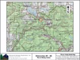
Wolverine #1 - #3
Placer Mining Claim
±117.5 Acres
Price: $15,000 $10,500
All three claims are to be sold together.
Amenitites:
- 2wd access on county-maintained road.
- Camping on claims or nearby campgrounds.
- Excellent metal detecting.
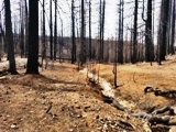
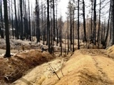
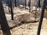
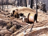
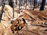
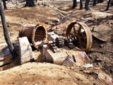
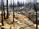
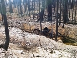
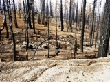
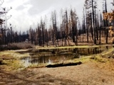
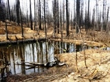
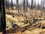
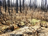
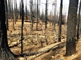
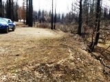
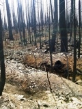
- The area burned in 2021 by the Dixie Fire, exposing the old workings and a stamp mill, although the vegetation is already growing back.
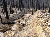
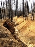
- Lots of old workings, including digs, prospect pits, tailing piles and even an old shaft. We believe it went down to bedrock (around 50+ feet) where the old timers tried to scurry around on bedrock. We further believe the ground water hampered their efforts.
- No trees or brush to hamper prospecting.
- Nearby gold sources produce bright chunky gold.
- Old tertiary gravel deposit with large volume potential.
- This claim could be good for heavy equipment and a trommel.
- Small Plan & Operations Permit through National Forest Service should be relatively swift.
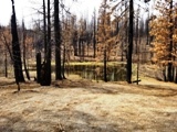
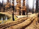
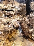
- Nearby creek with year-round flow; good for highbanker processing. Nearby pond has vegetation growing back and should be an oasis once again.
- Mining level: Recreational to advanced.
- Road closes late November - early December due to snow and opens up in late April - early May.
- Lake Almanor is 20 miles away with lodging, restaurants, general store, boating and fishing.
Click here to Google Map it.
Pinpoint is on USF Road 27N80 @ Northeastern Boundary.
Estimated GPS Coordinates:
Wolverine #1
Please adjust GPS to the following Datum & Coordinate display:
Datum: NAD83/WGS84
Coordinates: UTM
Zone 10
|
Easting
|
Northing
|
Elevation
|
| Northeast Corner Boundary: |
|
669208mE
|
4444892mN
|
5292 ft.
|
|
Northwest Corner Boundary:
|
|
668815mE
|
4444884mN
|
5187 ft.
|
| Southwest Corner Boundary: |
|
668824mE
|
4444482mN
|
5358 ft.
|
| Southeast Corner Boundary: |
|
669217mE
|
4444491mN
|
5383 ft.
|
Click on the Google Earth Fly To to view the Wolverine #1 claim and its boundaries.
Estimated GPS Coordinates:
Wolverine #2
Please adjust GPS to the following Datum & Coordinate display:
Datum: NAD83/WGS84
Coordinates: UTM
Zone 10
|
Easting
|
Northing
|
Elevation
|
| Northeast Corner Boundary: |
|
669199mE
|
4445300mN
|
5036 ft.
|
|
Northwest Corner Boundary:
|
|
669007mE
|
4445296mN
|
5017 ft.
|
| Southwest Corner Boundary: |
|
668606mE
|
4444879mN
|
5271 ft.
|
| Southeast Corner Boundary: |
|
669208mE
|
4444892mN
|
5292 ft.
|
| USF Road 27N80 Enters/Exits Northeastern Boundary: |
|
669200mE
|
4445253mN
|
5060 ft.
|
| Wolf Creek @ Northern Boundary: |
|
669055mE
|
4445297mN
|
5016 ft.
|
Click on the Google Earth Fly To to view the Wolverine #2 claim and its boundaries.
Estimated GPS Coordinates:
Wolverine #3
Please adjust GPS to the following Datum & Coordinate display:
Datum: NAD83/WGS84
Coordinates: UTM
Zone 10
|
Easting
|
Northing
|
Elevation
|
| USF Road 27N80 Northeast Corner Boundary: |
|
668815mE
|
4444884mN
|
5187 ft.
|
|
Northwest Corner Boundary:
|
|
668418mE
|
4444875mN
|
5356 ft.
|
| USF Road 27N92D Southwest Corner Boundary: |
|
668427mE
|
4444473mN
|
5291 ft.
|
| Southeast Corner Boundary: |
|
668824mE
|
4444482mN
|
5358 ft.
|
| Pond @ Southern Boundary: |
|
668644mE
|
4444498mN
|
5270 ft.
|
| USF Road 27N80 Enters/Exits Southern Boundary |
|
668712mE
|
4444479mN
|
5286 ft.
|
Click on the Google Earth Fly To to view the Wolverine #3 claim and its boundaries.
Standard Information
The Wolverine #1 - #3, placer mining claims are non-patented federal mining claims. You will need to file appropriate annual paperwork to hold the property every year. (Ask us about our Filing Service to assist you with that!) Annual property tax assessment is approximately $1.12 an acre
BLM Fees & Advanced Geologic Transfer Fees
Upon payment, the mineral claim will be transferred via a notarized Quitclaim notice filed in your name with Plumas County and the BLM. Limited payment terms and conditions are available; information available on request.
Advanced Geologic has an exceptional automatic claim notice filing system that will maintain your annual filings for any claim in the United States. Advanced Geologic reminds you that you MUST file annual notices with both the county in which the claim is located AND with the Bureau of Land Management by the appropriate dates. There are NO exceptions and errors will lead to the loss of your claim! Are your claims filed correctly?
Advanced Geologic is a professional geologic consulting firm located in Chester, California. We not only sell quality mining claims, but we also help people work their claims. Our experience in resource evaluations, compliance and permitting and claim portfolio management allows our clients and buyers to go for the GOLD.
Interested? Send us an email or call.
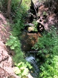
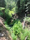
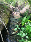
The pictures below were taken in late winter, after the single largest wildfire in the state's history. The Dixie fire devastated much of Plumas County. We plan to get more pictures soon to show the new growth in the area, the least of which will include new budding trees and ground cover taking over. We look forward to showing you the beauty that can grow out of a fire. Although these claims might be burnt out now, they will be magnificent once again within a few years. In the meantime, the area is rich for prospecting.
