|
|
| Placer Mining Claims For Sale | ||||||||||||||||||||||||||||||||||||||||
|
|
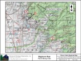
Bighorn Run ±80 Acres BLM CAMC #pending
Price: $7,000 Click here to print info, maps, GPS coordinates, driving directions Maps, Historical Information, Photos, GPS and Google Fly To are all current. Please check back soon for further info. Our Bighorn Run placer claim, is located in the Yankee Hill gold district, that is in east-central Butte County about 15 miles northeast of Oroville. It is fairly extensive and includes the Concow and Big Bend areas. History: The streams and surface placers were first worked during the gold rush. For a time the locality was known as Rich Gulch and Spanishtown. In those days much gold was recovered from the North Fork of the Feather River, and a diversion tunnel was driven through Big Bend. Numerous Chinese miners reowkred the old placer tailings later on. Lode mining began in the 1850s, and there was much activity during the 1890s and early 1900s. The Surcease mine was worked on a major scale from 1933 to 1942, and copper was mined at the nearby Big Bend mine during World War II. The estimated output of the district is slightly more than 100,000 ounces of gold. Geology: A northwest-trending belt of slateand quartzite four to five miles wide, with some limestone that is part of the Calaveras Formation (Carboniferous to Permian), crops out in the central part of the district. Interbeds of amphibolite and serpantine lie to the north. Granodiorite stocks are to the east and the southeast. Ore Deposits: A number of quartz veins contain some free gold and often abundant sulfides, especially chalcopyrite. The veins are in the metamorphic rocks. Milling ore commonly averages 1/2 ounce of gold per ton, much of the values being in the sulfides. The Surcease vein has been mined to a depth of more than 1000 feet. A gold-bearing barite vein occurs at the Pinkston mine. Claim Georeferences
Click here Google Earth Fly To and see an aerial photo of the Bighorn Run and the claim boundries. Estimated GPS Coordinates:
Standard Information The Location Notice for the Bighorn Run placer mining claim has been recorded at the Butte County Recorder's Office (see registered number above) and the Bureau of Land Management federal mining claim number is pending. It is a non-patented federal mining claim. Fees are current for 2014 and you will need to file appropriate paperwork to hold the property every year thereafter. Annual tax assessment on the property is approximately $1.12 an acre. BLM Fees & Advanced Geologic Transfer Fees Upon payment, the mineral claim will be transferred via a notarized Quitclaim notice filed in your name with Butte County and the BLM. Limited payment terms and conditions are available; information available on request. Advanced Geologic has an exceptional annaul claim paperwork filing service that will maintain your annual filings for any claim in the United States. Advanced Geologic reminds you that you MUST file annual notices with both the county in which the claim is located AND with the Bureau of Land Management by the appropriate dates. There are NO exceptions and errors will lead to the loss of your claim! Are your claims filed correctly? Advanced Geologic is a professional geologic consulting firm located in Chester, California. We not only sell quality mining claims, but we also help people work their claims. Our experience in resource evaluations, compliance and permitting and claim portfolio management allows our clients and buyers to go for the GOLD. Interested? Send us an email or call. |

|
||||||||||||||||||||||||||||||||||||||